Up to date North Atlantic hurricane and storm activity and forecasts - "Laura" now category 1 hurricane and set to strengthen
The 2020 season started on 1 June and runs officially through to the end of November.
So far in the 2020 Atlantic hurricane season there has been:
- Tropical Storm Arthur - 16/19 May - not a significant event.
- Tropical Storm Bertha - 27/28 May - the first landfalling TS - not significant at all, caused heavy rainfall in Florida and South Carolina.
- Tropical Depression Cristobal - 1 to 10 June - flooding in Central America, made landfall Louisiana as a tropical depression. Karen Clark catastrophe modelling firm provided an estimate of insured losses of US$150m. This is the earliest a third named storm has ever formed during a hurricane season in the Atlantic Basin. This may or may not indicate increased activity to come.
- Tropical storm Dolly - 23 - 24 June - formed very far North, eventually dispersing.
- Tropical storm Edouard - 6 July - petered out and did not make landfall.
- Tropical storm Fay - 9 July - 11 July - the storm made landfall in New Jersey . Karen Clark catastrophe modelling firm provided an estimate of US$400m insured losses.
- Tropical Storm Gonzalo - 22 July - not a significant event.
- Tropical Storm/Hurricane Hanna - 24/26 July - the eighth named storm and the first hurricane of the 2020 season. The first hurricane since Harvey to make landfall in Texas. Sustained 90mph winds as it came shore at Padre Islands (a long barrier island) on the southern coast of Texas bringing storm surges and heavy rainfall as portrayed in #HurricaneHanna bringing flooding and likely property and marine losses. Not expected to be a significant London market loss. Karen Clark has estimated the insured loss to be US$350m. The catastrophe modeller RMS has opined at US$400m - see here for their article.
- Hurricane Isaias - 29 July - 4 August: No longer an active hurricane having been downgraded after running up E USA and into Quebec. After passing over Andros Island (part of The Bahamas) Isaias made landfall in N Carolinaas as a category 1 hurricane bringing heavy rainfall and 85mph force winds. It then interacted with the jet stream and moved quickly as a tropical storm through Virginia, Maryland, Pennsylvania, New York, New England. More information from TSR available here and charts available here. Isaias was the second landfalling hurricane of the 2020 season and the earliest forming "I" named storm in records. KCC has opined (see "Flash Estimate 7/8 available here by providing details) that based upon high resolution models the industry insured loss is estimated at US$4bn for the US and US$200m for Caribbean losses (Dominican Republic and Bahamas). RMS has estimates of US$3-5bn arising from residential property wind-related claims.
- Josephine - 14 - 16 August : dissipated out at sea.
- Kyle: 13/8 - merged with European storm Ellen bringing strong winds to UK 20/8.
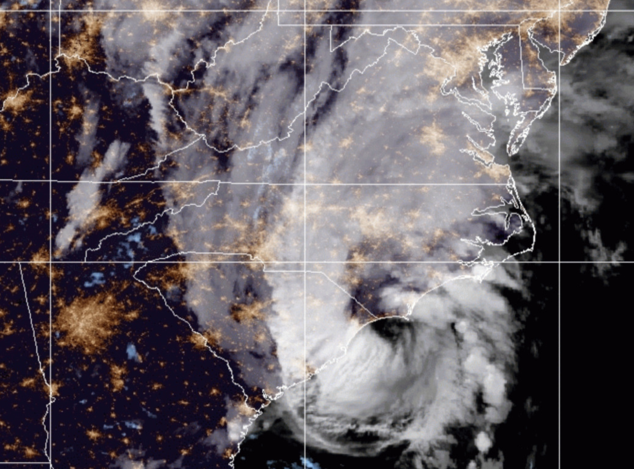
- Laura: 20/8 & ongoing - category 1 level hurricane from 25/8 - as expected en route through Gulf of Mexico: current location and projected path visible here at TigerRisk. Laura currently has 75 mph winds and is on a path towards Louisiana through the Gulf of Mexico and forecast to make landfall Thursday morning. Significant strengthening is forecast during the next 48 hours, and Laura is expected to be a major hurricane at landfall.
- Marco: According to NOAA charts visible here tropical storm Marco downgraded and travelling parallel to the Texas coast with 30 mph winds. No need to monitor this now.
Future storms
When new storms reach tropical storm strength, they will receive the following names: Nana, Omar, Paulette, Rene, Sally, Teddy, Vicky, Wilfred.
Hurricanes have winds of winds of at least 74 mph; major hurricanes at least 111 mph. See Saffir-Simpson categories here.
Affect of Covid-19 on insured losses
Karen Clark has written a short article available here as a pdf which examines the issue that losses from hurricanes will increase as a result of the complications caused by Covid by betweeen 20 to 25%.
----------------------------------------------------
Mid-August updated hurricane forecasts
"Skill starts to climb as the hurricane season approaches with moderate-to-good skill levels being achieved, on average, by early August." says TSR and so relevant to see the recently produced forecasts, tabled below:
| Mid-August forecasts for storm and hurricane activity | ||||||||||
| 1950 - 2019 average | 2010 - 2019 average | UK Met (May) | CSU (May) | CSU (Aug) | NOAA (May) | NOAA (Aug) | TSR /UCL (May) | TSR / UCL (Aug) | ||
| Tropical Storms | 12 | 16 | 13 | 19 | 24 | 13 - 19 | 19 - 25 | 17 | 24 | |
| Hurricanes | 6 | 7 | 7 | 9 | 12 | 6 - 10 | 7 - 11 | 8 | 10 | |
| Major hurricanes | 3 | 3 | 3 | 4 | 5 | 3 - 6 | 3 - 6 | 3 | 4 | |
| TSR / UCL = | University College London for Tropical Storm Risk | |||||||||
| CSU = | Colorado State University | |||||||||
| NOAA = | National Oceanic and Atmospheric Administration | |||||||||
The Jeff Masters and Bob Henson Blog contains much useful information on the formation and possible track of hurricanes - Jeff's last year of providing his commentary here - he has moved to Yale Climate Connections and his informed commentary on all matters meteorological are available here called "Eye On The Storm."
Signup here for alerts from Tiger Risk
Signup here for alerts from Tropical Storm Risk (TSR)
------------------------------------------------
If you would like to be added to the distribution list of published articles, please email: [email protected]